Girdwood THEN vs NOW series: Part 2

Digging through the archives we found a couple of old maps of Girdwood and thought it would be interesting to compare the two. Click on the arrow in the center of the map and drag it left and right to compare the maps so you can see the differences for yourself.

before after

Comparing 1952 & 1984 Maps of Girdwood

To enlarge, click read more link below.

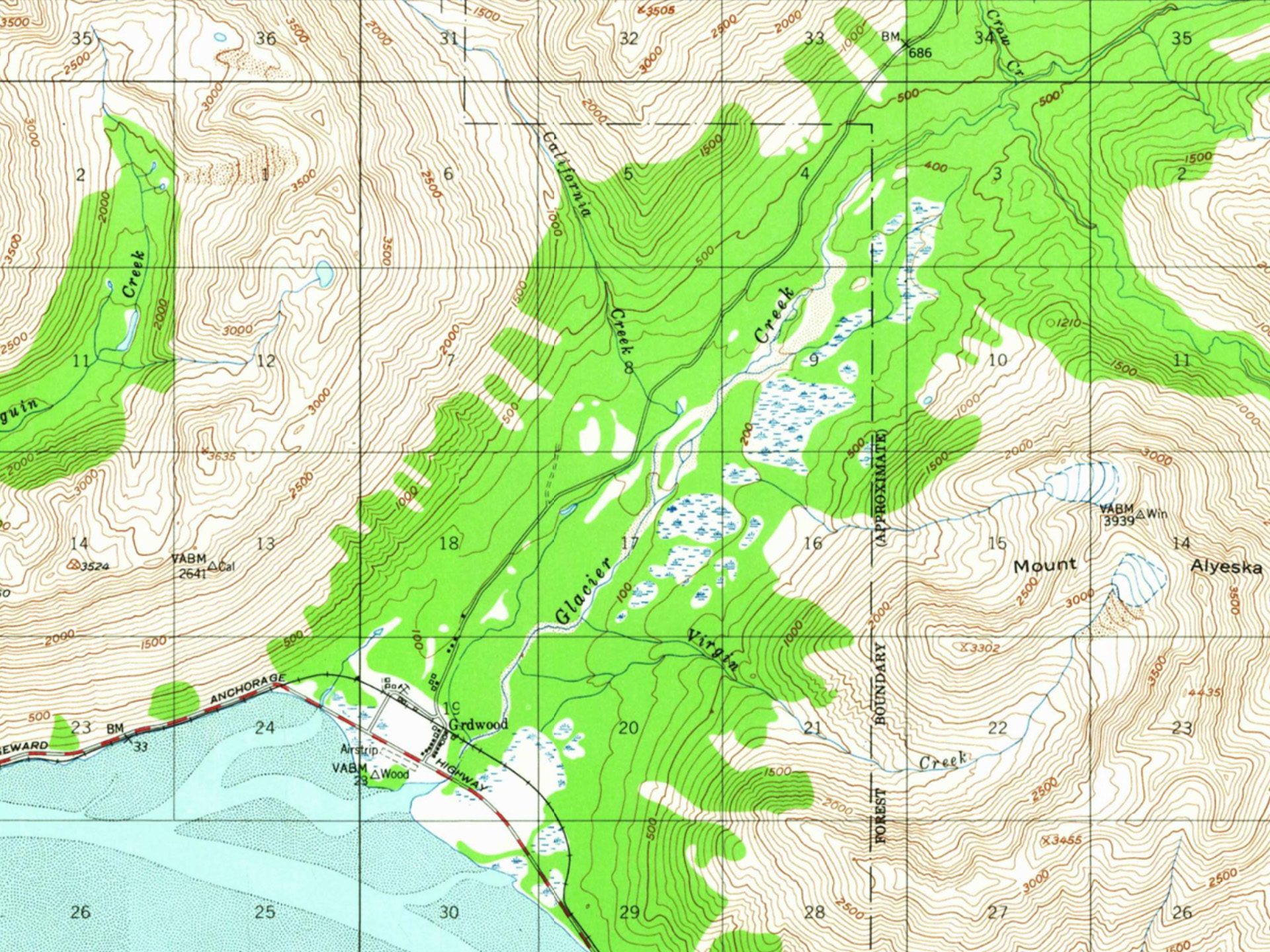
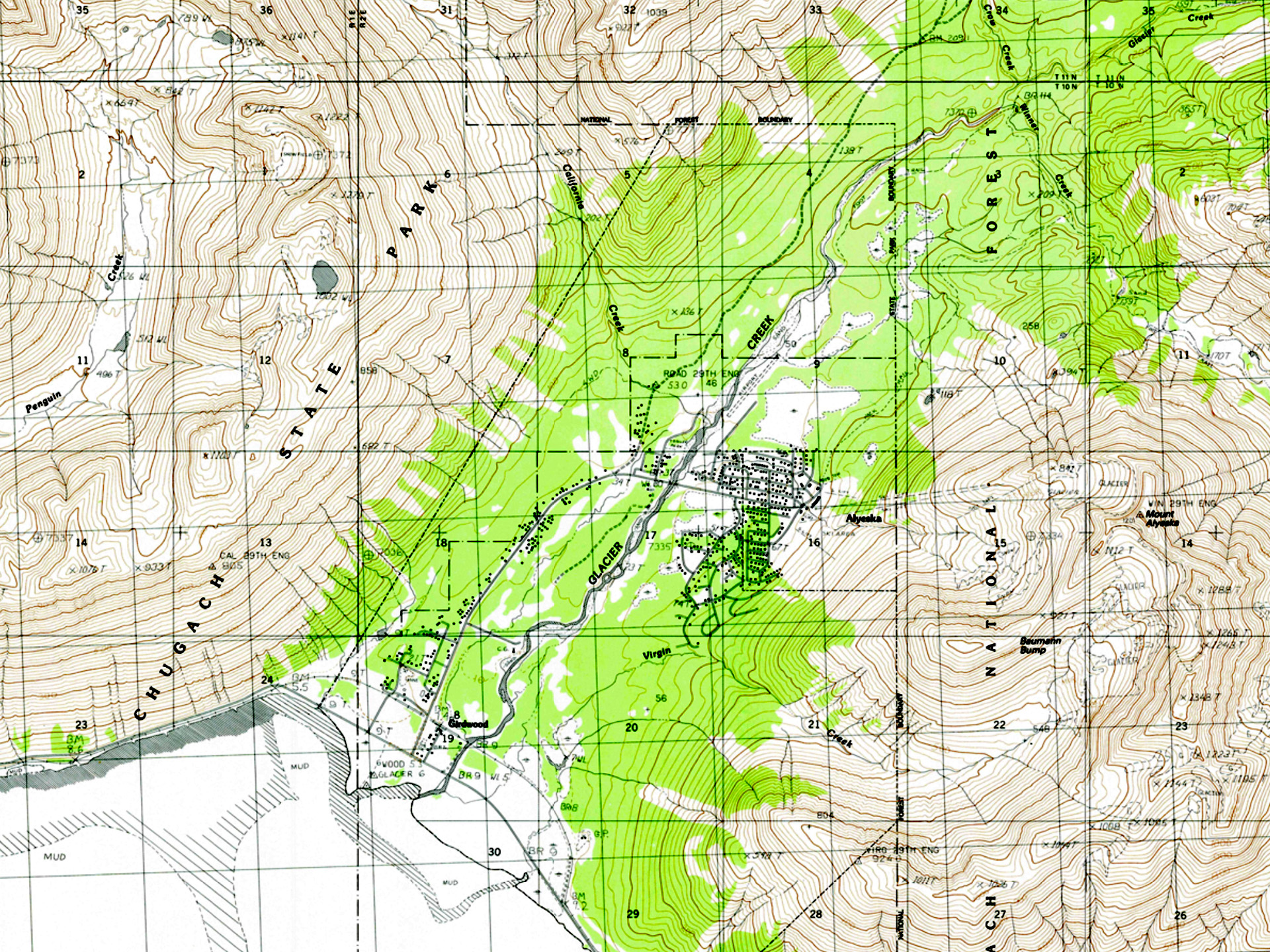
With the 1952 map being pre-earthquake, and with all the changes it caused, it took a bit of time and numerous tweaks to get the maps to line up correctly. In the end, the only point that we could get it to line up from was ???

So, it must have been fate, when we discovered an old image of the archives of almost exactly that spot.

And of course, we couldn’t resist taking a 2022 photo and making a then and now of that too.

Vintage Girdwood before Vintage Girdwood after

The Old Girdwood Train Station location at the end of Main Street

The description is taken from the caption on the original print. "People are getting onto a railroad car at the Girdwood railroad station, circa 1944 to 1945." To enlarge, click read more link below.
Railroad crossing
Car crossing railroad crossing on to Main St.
Main St
Bus heading down Main St. to the Seward Highway in 1954.
Main St
Main St looking South toward Turnagain Arm
Girdwood Hotel
Girdwood Hotel located on Main St.

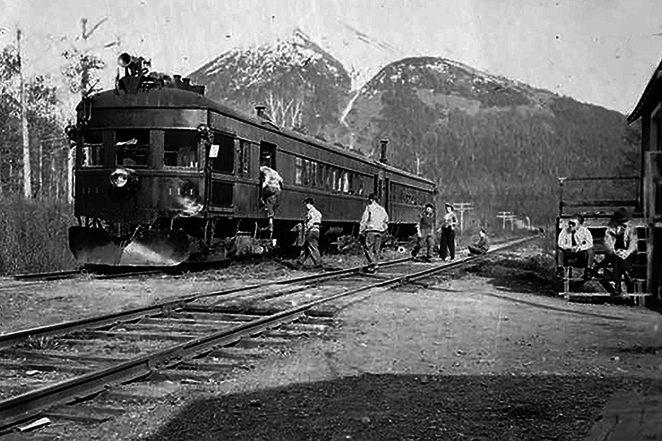
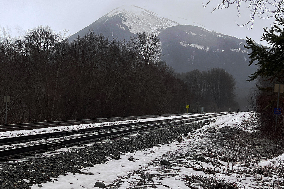
Streetview 1920 vs Streetview 2020

Streetview
1920 Streetview of Main St.
Streetview
2020 Google Streetview of Main St.